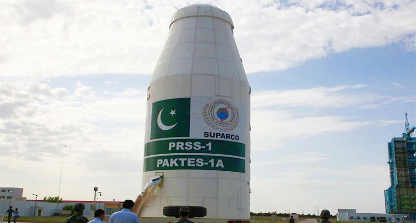
Suparco, Pakistan’s space agency Said, this is big achievement for the country growing space program. Pakistan will be able to keep a closer eye on the planet. It can assist with significant projects like the China-Pakistan Economic Corridor (CPEC), inspect crops, and conduct environmental studies. It will also aid in managing natural resources, planning cities, and early detection of hazards like landslides or floods.
This is Pakistan’s second remote sensing satellite after PRSS-1, launched in 2018. Now, Pakistan has five satellites working in space, which improves the country’s ability to manage disasters and keep an eye on important developments from above.
Also Read: SBP selects new currency notes design
The launch fits into Pakistan’s big plan called National Space Policy and Vision 2047. The new satellite has advanced cameras and tools that will help predict natural disasters like floods, earthquakes, and glacier melting. It will also support farming, city planning, and tracking climate changes.
Federal Minister for Planning Ahsan Iqbal congratulated everyone on this success. He thanked China for helping Pakistan with the launch. On social media, he called this launch “another URAAN of Pakistan” and said it makes the friendship between Pakistan and China even stronger.
Iqbal also shared exciting news that next year, Pakistan, with China’s help, will send its first astronaut into space. He also said Pakistan plans to send a mission to the Moon by 2035.
Pakistan’s space journey started in 2011 with PakSat-1R and continued with more satellites over the years. In 2024, Pakistan launched PakSat-MM1, which brings fast internet to remote areas. The country’s first student-made lunar satellite, iCube Qamar, even took pictures of the moon.
In January 2025, Pakistan launched its first fully made local satellite, EO-1, designed for farming, disaster help, and watching the environment. This shows Pakistan’s strong growth in space technology.


